A village on the Italian island of Sicily has gone viral over its unique shape.
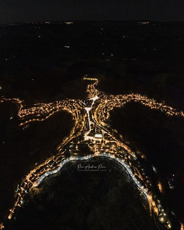
The small town of Centuripe is known for its wealth of Roman ruins and rare ancient sculptures, but a drone shot from the air has uncovered its rare shape – an uncanny resemblance to a person with arms stretched out.
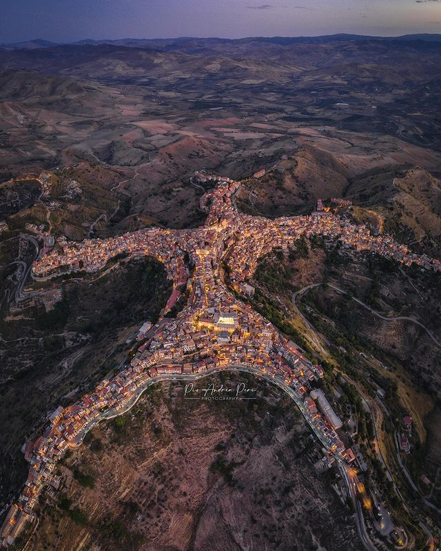
Photographer and drone pilot Pio Andrea Peri noticed his hometown’s unusual shape on Google Earth and decided to use his drone to see if it was true.
He flew his drone as high as he could above the town and began taking photos.
To his surprise, it revealed the shape of a human.
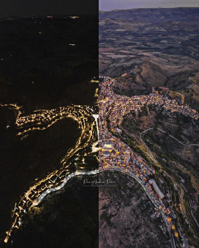
But due to the limitations of his drone, Peri reportedly needed to stitch together several photos to fit in the entire village.
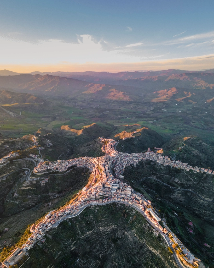
Aerial images show two longer stretches of buildings that resemble ‘arms’ and another two resembling ‘legs’, while a shorter fifth stretch makes up the ‘head’.
“It was a hard shot to create,” he said. “I had to use multiple shots because of the height limit of the drone.”
Peri took the snaps in 2021 and they have since resurfaced on social media with many amazed by the village’s resemblance to a person.
“There are those looking from above who see a man lying down, then there are those who see a starfish … How about you? What do you see watching Centuripe?” he asked his Instagram followers alongside one of his aerial shots.
“Wow, this town has such an incredible shape,” one person responded.
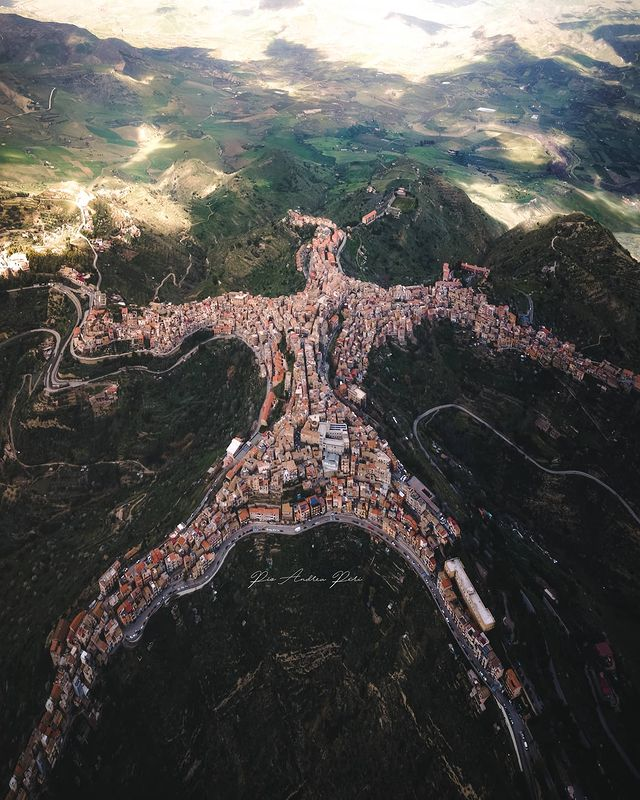
“Love this! I see a man living free with the land!” wrote another.
Meanwhile, a local thanked the photographer for his work.
“Centuripe deserved some visibility and we are honoured that a master like you gave it. Gorgeous pictures,” they wrote.
Others described the village’s shape as “crazy”, “incredible” and “cool”.
“Would love to see how the people get around. I see one road around the outer edge. Very interesting,” a Facebook user wrote.
“I’m on my way from the right arm, should be to the left arm oh I’d say in about an hour or so,” said another.
“In a country shaped like a boot, there’s a town shaped like a person,” a third added.
However, while many were amazed by Peri’s images, some accused him of doctoring them.
“The whole world was incredulous at the bizarre shape of this town. Many did not believe it was true, and they thought that I had drawn the photo on the PC,” Pio said, according to the Daily Mail.
“But when they realized the truth by searching on Google Earth many of them personally apologized for what they said to me.”
“I’m proud of the pictures and I’m happy with my results; being a self-taught person I believe a lot in what I do.”
He explained how difficult it was to create the final image.
“I overlaid about 18 shots manually in post production and it took two hours of editing. I’m very happy with the result.”
At the time, the town’s mayor invited photographer Peri to stage an exhibition of his photographs.
The ancient town of Centuripe, built on a hill about 730m above sea level, has a population of around 5000 inhabitants.
The town’s current layout and design is said to date back to the 16th century with its tiny, winding streets leading down to terraced buildings.
The picturesque alleyways are reportedly designed for animal transport.
Due to its high position, Italian general Giuseppe Garibaldi called Centuripe “the balcony of Sicily”.
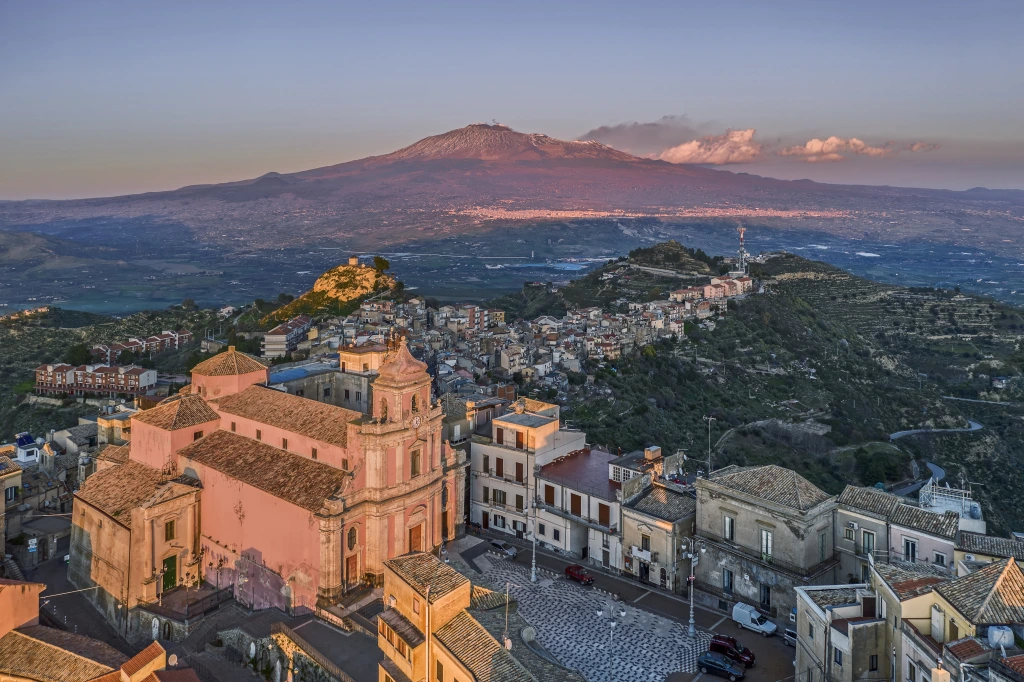
From the top of the town, the famous Mt Etna, one of the world’s most active volcanoes, is visible in the distance, as are sprawling views of the surrounding countryside.
